Digitised by the Proyecto Turismo y Salud
Original document stored in: Biblioteca Municipal de La Orotava
You can browse the digitisation for free (check the terms of use).
Los derechos de todas nuestras digitalizaciones pertenecen a la Fundación Canaria Orotava de Historia de la Ciencia y, en cada caso, a la institución depositaria de los ejemplares originales.
Cualquier uso de las mismas debe ser autorizado expresamente.
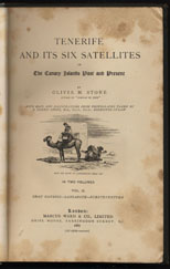
Tenerife and its six satellites or The Canary Islands past and present. Volume II.
With maps and illustrations...
With maps and illustrations...
| Bibliographic information | |
| Authors | |
| Year | 1887 |
| Type | Libro |
| Edition | |
| Volumes | 1 |
| Number of pages | 459 |
| Physical description | Incluye ilustraciones y mapas, 23 cm. |
| Notes | Tiene traducción al español editada por el Cabildo de Gran Canaria en varios tomos. Vol. 1: Tenerife, Gomera, Hierro. Vol. 2: Gran Canaria, Lanzarote, Fuerteventura. |
| Some libraries that hold this document |
|
| Places | Canarias |
| Languages | Inglés |
| Scientific categories | Geografía física - Historia |
| Labels | Cartografía - Descripción |
| Digitisation info | |
| Places | Canarias |
| Languages | Inglés |
| Scientific categories | Cartografía - Geografía física - Historia |
| Date | |


